The Quiet Side of Annapurna
North Annapurna Base Camp at 4,190 metres, up the trail Maurice Herzog walked in 1950. Four days, one broken jeep, and a mountain almost nobody queues for.
By Ujjwol Kayastha · May 1–4, 2025 · Myagdi, Nepal
Everyone walks into Annapurna from the south. You have seen those photographs: the amphitheatre, the sunrise queue, Machhapuchhre doing its perfect triangle for four hundred phones. This is the other door. From the north the mountain is not an amphitheatre, it is a wall, and the path to the foot of it is the one Maurice Herzog's expedition took in 1950 on the way to becoming the first people to stand on top of an 8,000-metre peak. Seventy-five years later the trail carries his name, a hand-painted board at the roadhead, and almost nobody. We left Swayambhu at 17:25 on a night bus with the seat covers still smelling of the factory, and came back four days later having seen Annapurna I from a valley where we could hear the glacier working.
- days door to door: 4
- high point · North ABC: 4,190 m
- the wall above camp: 8,091 m
- jeep, broken: 1
The bus, and the long dark (Day 01 · May 1)
SWAYAMBHU → MUGLING
- 17:25 off from Swayambhu
- 23:30 Mugling
There is a particular optimism to boarding a night bus at 17:25. The seats are clean, nobody has taken their shoes off yet, and the eleven hours ahead of you are still theoretical. We had a plan that fit on one line: get to Humkhola, walk up the Herzog trail, stand at the foot of Annapurna's north face, come back. Four days. On paper it is barely a trek. On paper.
 Seat covers still blue · 17:28Somewhere on the Prithvi Highway · 20:10
At 23:30 we stop at Mugling, because everyone stops at Mugling. It is less a town than a national rest area with opinions about dal bhat. Buses idle nose to tail, a man in a hi-vis vest waves torches at nothing in particular, and the whole place smells of diesel and frying onions at the same time. Ten minutes, then back into the dark.
 Mugling, where every bus in Nepal meets · 23:38
A broken jeep and 2,500 metres (Day 02 · May 2)
NAYA BAISARI → TATOPANI → HUMKHOLA → PHUTPHUTE → SADHIKHARKA → BHUSKETMELA
- 05:00 Naya Baisari
- 08:40 off to Humkhola
- 09:42 jeep gives up
- 10:10 resumed
- 10:55 Humkhola, 2,883 m
- 12:30 Phutphute
- 13:13 Sadhikharka
- 15:30 Gupha Phant
- 17:15 Bhusketmela, 3,651 m
Naya Baisari at 05:00, then breakfast somewhere under a woven bamboo ceiling with bananas hanging from the rafters and a green plastic table that had clearly survived worse mornings than ours. By Tatopani the valley has closed in and the village has put a ceiling of prayer flags over its one street, which is the sort of thing that makes you stop and take a photograph even when you have a jeep waiting.
 Breakfast, 06:07, bananas overhead · 06:07
 Tatopani, under the flags · 08:19
We leave for Humkhola at 08:40 and at 09:42 the jeep stops being a jeep. Gaadi bigriyo. The road up the Kali Gandaki is the kind that eats vehicles for a living, and ours had simply had enough. What follows is the most Nepali twenty-eight minutes imaginable: everyone gets out, nobody panics, two people who are not mechanics confer with authority under the bonnet, and at 10:10 it starts again for reasons no one can fully explain. Nobody even mentions it afterwards.
The twenty-eight minute intermission · 09:50Humkhola at 10:55, 2,883 metres, and the driving is over. There is a blue tin shed, a white 4WD that made it further than ours, and a hand-painted board from the Ministry of Tourism that turns out to be the single most useful object of the trip: the whole trail drawn in white and blue, every camp labelled with its height, Nilgiri South at 6,839 and Baraha Chuli at 7,647 sketched in above like a warning. Across the bottom, in yellow capitals: Maurice Herzog Trail. Under it, almost as an afterthought, Annapurna I, 16 km 800 m.
 Where the driving ends · 10:57
 The board that plans your trip for you · 11:07
We start walking at 11:11. Phutphute at 12:30, which the note spells six different ways and the board spells properly: a waterfall that has cut a slot straight down through smooth grey rock and fires into a pool the colour of a swimming pool advertisement. Sadhikharka at 13:13, 3,160 metres, and lunch. Off again at 14:40.
 Phutphute, and a slot in the rock · 12:39
 Gupha Phant: bench, tarp, opinions · 15:32
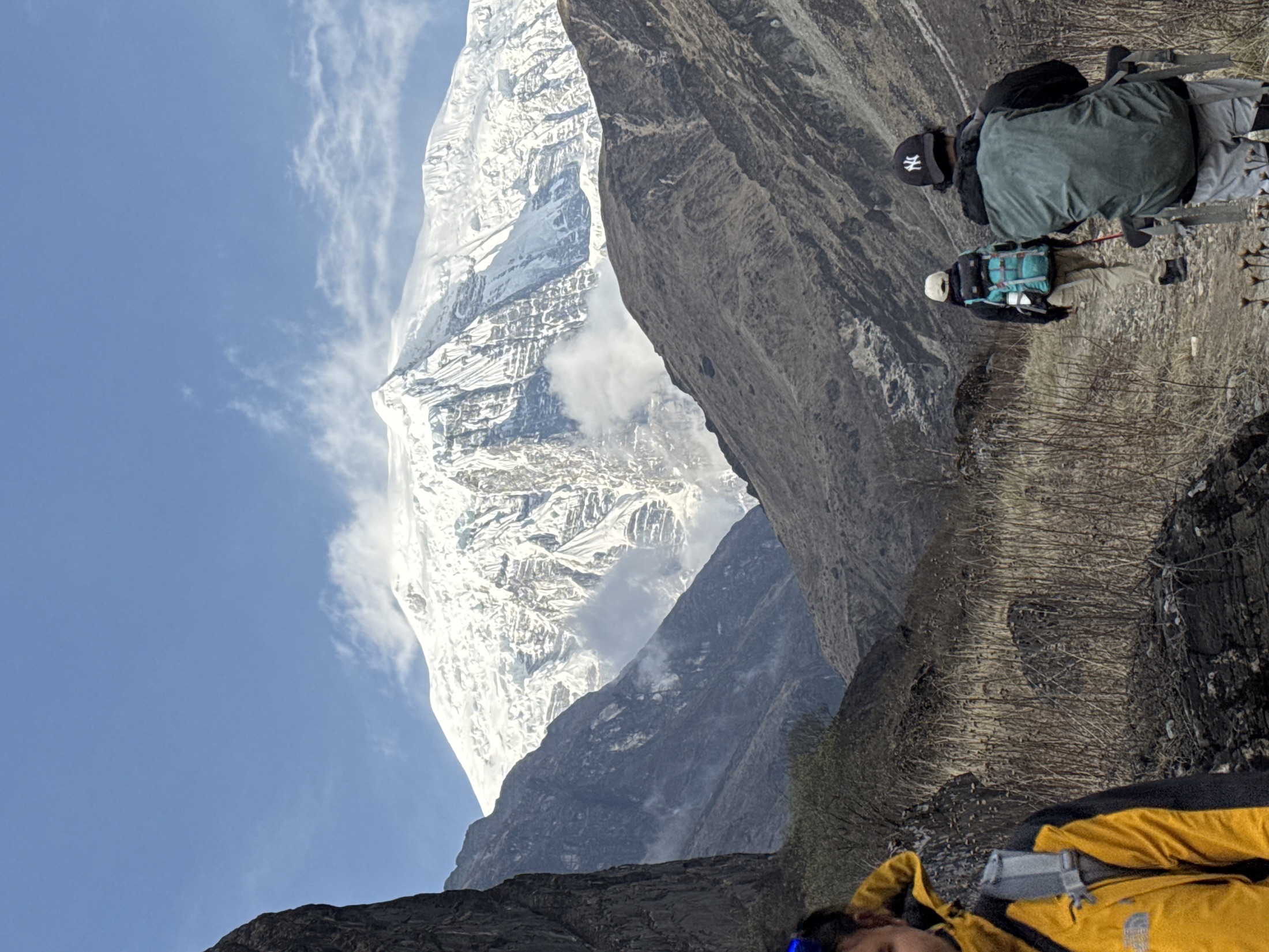
Then, at about a quarter to five, the valley finally lets you see what you came for. A snow face comes out of the cloud above the ridgeline and simply keeps going up, and the trail ahead of you fills with people who have all stopped walking at the same moment for the same reason. Nobody says anything useful. Someone says oi. That covers it.
 The first white thing all day · 16:47The wall shows up for work · 16:57Single file, last hour of light · 17:02
Bhusketmela at 17:15. Somebody has painted the altitude onto the black boulder the camp is built around, and the tents are laid out beneath it in colours that have no business being that cheerful at 3,651 metres: yellow, red, green, a blue one at the back. Six and a half hours of walking, two and a half thousand metres of road and trail since breakfast, and the cold arrives about four minutes after the sun leaves.
 Bhusketmela, altitude painted on · 17:27
The wall, at last (Day 03 · May 3)
BHUSKETMELA → PANCHA KUNDA → NORTH ABC → BHUSKETMELA → SADHIKHARKA
- 03:30 wake
- 04:55 off to Pancha Kunda
- 07:25 Pancha Kunda
- 07:45 off to base camp
- 08:25 North ABC, 4,190 m
- 09:55 turn for home
- 15:07 Bhusketmela
- 17:40 Sadhikharka
Nobody sleeps well at 3,651 metres, which turns out to be a gift. Step outside at four in the morning and the sky over Bhusketmela is doing the thing it only does when you are far enough from a road: the Milky Way laid diagonally across the whole valley, and our tent glowing yellow underneath it like something left on by accident.
 Why nobody slept properly · 03:55
 A tent doing its best lamp impression · 04:01Head torches, 04:55, nobody talking · 04:55
Off at 04:55 in head torches. The climb from Bhusketmela goes up through Sunkhola at 3,843 and the camp site at 4,050, and somewhere in there the vegetation gives up entirely and hands the valley over to rock. At 07:25 we reach Pancha Kunda: five lakes, or at least one very persuasive one, a flat sheet of glacier-milk turquoise pressed against a moraine slope so large it takes a moment to find the two people walking along the shore for scale. They are wearing red. They are the size of a comma.
 Pancha Kunda, and two people for scale · 07:22
The last forty minutes are pure moraine: a thread of stone-lined path through boulder rubble, the glacier tongue ahead of you, and a hole punched in the cloud that drops one column of light onto the whole mess. At 08:25 the ground flattens out and stops pretending, and you are at North Annapurna Base Camp, 4,190 metres.
 The last hour is all moraine · 07:48
What is in front of you is not a viewpoint. It is a wall: ice cliffs, hanging séracs, a glacier pouring down out of them and spreading across the flats you are standing on, and above all of it the north face of Annapurna I going up another four kilometres into the sky. You can hear it. That is the part the photographs cannot carry. Ice moves somewhere out of sight and the whole basin makes a sound like furniture being shifted in an upstairs room.
The basin, from the flats · 08:31The north face, doing nothing at all, loudly · 08:44From the south Annapurna is a view. From the north it is a wall, and you can hear it working. 4,190 metres, 08:25
We stay ninety minutes, which is both far too long in that wind and nowhere near enough. There is no lodge here, no bakery, no queue, no one selling anything. On the whole morning we see a handful of other people. The south side of this same mountain processes that many every ten minutes in season.
Then the arithmetic of a four-day trip arrives: everything you climbed, you now un-climb, and you do it in one go. Turn at 09:55, Pancha Kunda again at 10:50, Bhusketmela at 15:07 for a tea that tastes like a reward, and on down to Sadhikharka by 17:40. Eleven hours of moving. Legs entirely finished. Nobody complains, because everybody is still thinking about the noise.
 Back down to the coloured tents · 15:08
Down, then north, then home (Day 04 · May 4)
SADHIKHARKA → HUMKHOLA → TATOPANI → MUKTINATH → MARPHA → BENI → KATHMANDU
- 04:10 off in the dark
- 05:40 Humkhola
- 07:30 Tatopani
- 09:45 Muktinath, 3,760 m
- 13:30 Marpha
- 18:00 Beni
- 21:45 Pokhara
- 06:20 home
Walking again at 04:10, in the dark, on purpose. Humkhola by 05:40, where the river runs past a small hydro intake holding a rectangle of impossibly turquoise water, and the forest is still full of mist. Tatopani at 07:30. The trek is over in under four hours, which feels like cheating after yesterday.
 Humkhola, and the turbine that runs it · 05:30The last of the trail · 06:15
And then, because we had a jeep and daylight and no sense, we kept going north. Up the Kali Gandaki, through the wind tunnel, into Mustang. Muktinath by 09:45 at 3,760 metres, which is higher than we slept at Bhusketmela and reached entirely by sitting down. The landscape changes religion somewhere around Jomsom: green gorge becomes brown desert, trees stop, and the light goes hard and flat and enormous.
 Muktinath: brown hills, blue jeeps, no trees · 09:49The road down to Marpha · 13:10
Marpha at 13:30 for apples and the local product they are distilled into, which we bought responsibly and drank on a schedule. Back through Tatopani at 16:20, Beni by 18:00, and then the long rewind: Kushma at 19:45, Pokhara at 21:45, a food stop at Bharchaur in Tanahun that we left at 23:43, Kalanki at 05:20, and through my own front door at 06:20.
Four days. One of them was a mountain. Three of them were the road, and the road is most of the story. Swayambhu to Swayambhu
Go before it changes. The road is creeping up the Kali Gandaki a little further every season, and the day it reaches Humkhola properly this becomes a very different trip. For now the Herzog trail still asks you to walk, still has a hand-painted board instead of a ticket office, and still ends at a wall of ice with nobody standing in front of it. On the south side of this mountain you queue for sunrise. On the north side we had the whole thing to ourselves before nine in the morning.
All travel stories · Back to the portfolio